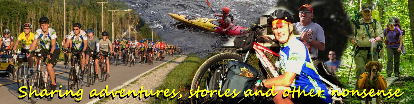
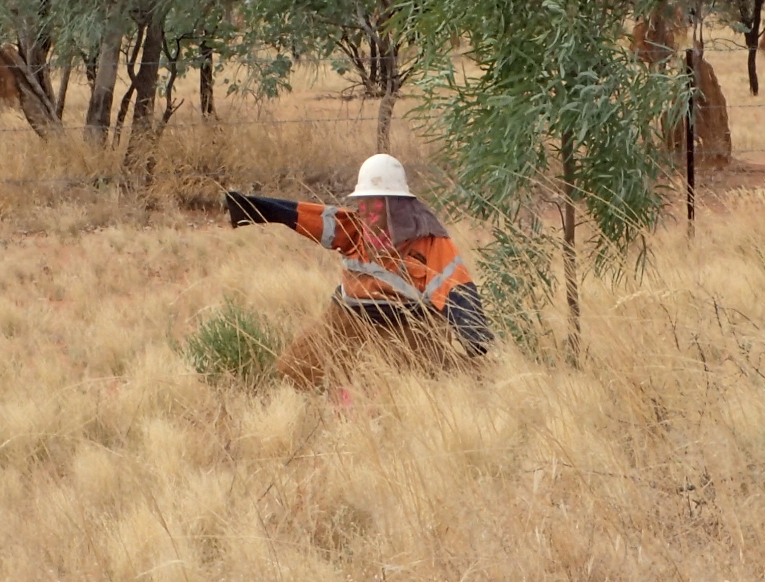
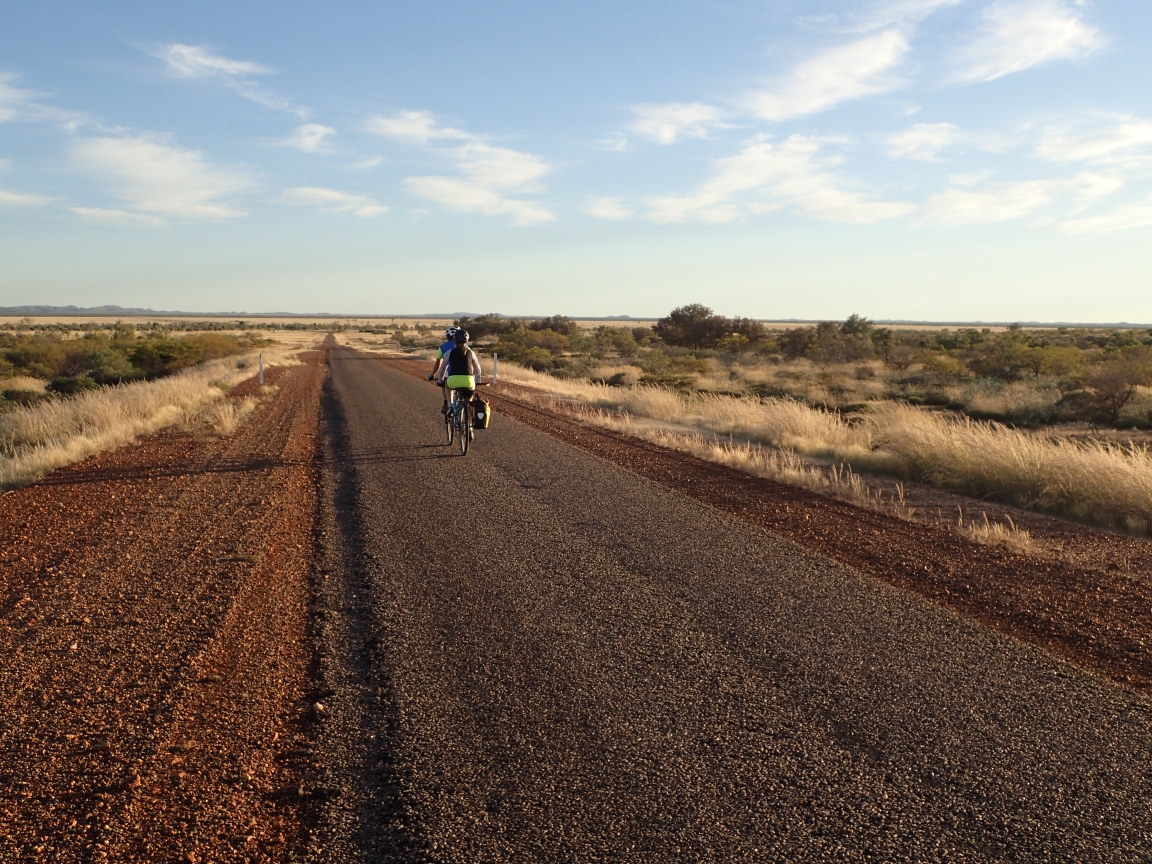
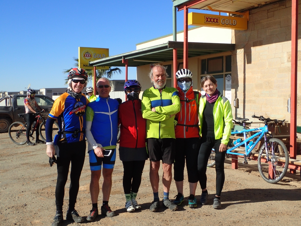
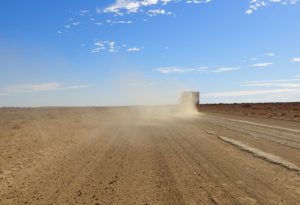
Our day started with a late morning and a gropu photo in from of Cloncurry’s Post Office Hotel, across the street form the…wait for it…Post Office. We are heading north with strong winds at our back. It is time for the bikes to fly. The peddles crank away with little effort and the kilometres fly by with these conditions. The road today is less travelled and there is time to enjoy the scenery. In na previous post I mentioned the termites who’s mounds sometimes take over the landscape. Along this road I noticed that they have become somewhat devious taking to adopt a human disguise. I wonder what they are up to.
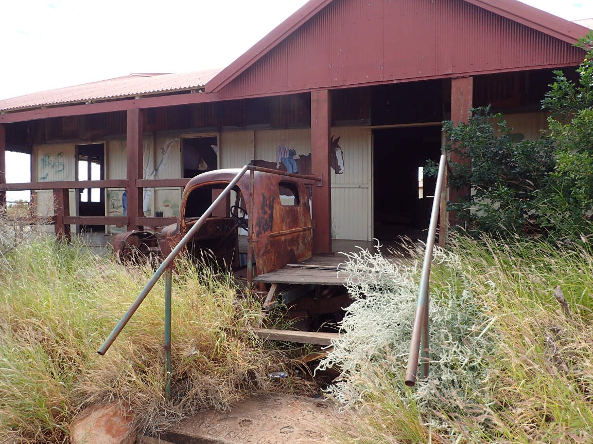
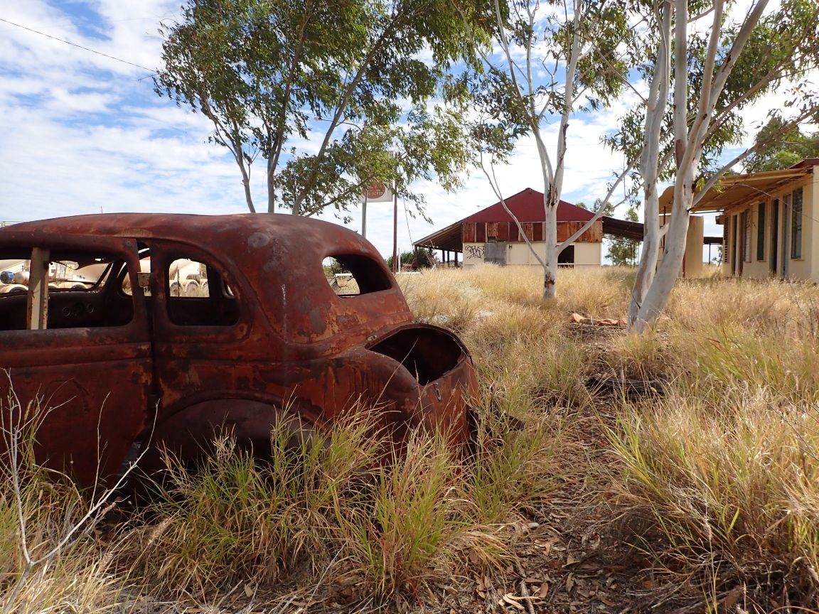
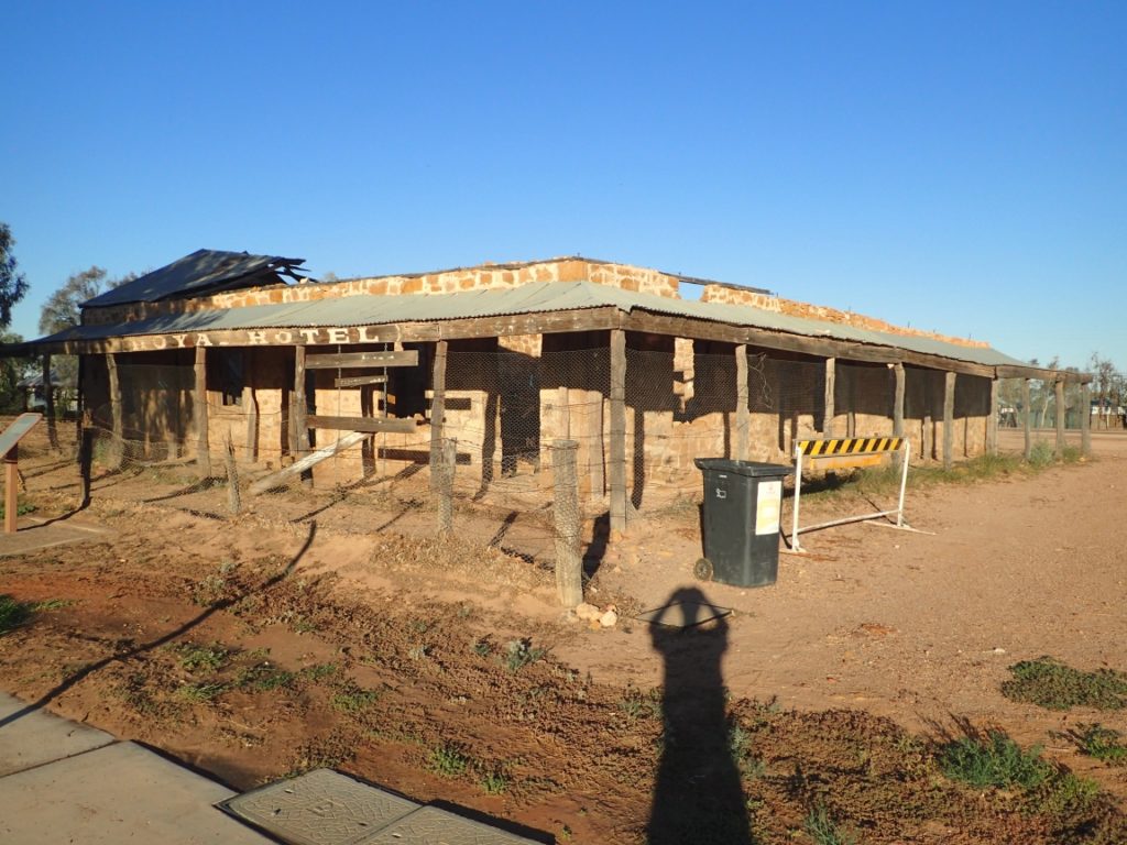
The Quimby Hotel check in at your own riskOur lunch stop was at the Quimby Hotel a one time oasis for thirsty and weary travellers. Today it is just another ghost along the highway. It must have been a swinging place at one time with rodeos, dancing, drinking and rooms to rent. All quiet now as rust and rot are the primary guests.
Come for the night and stay until you rust.
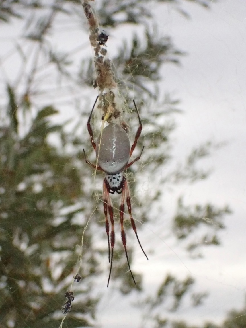
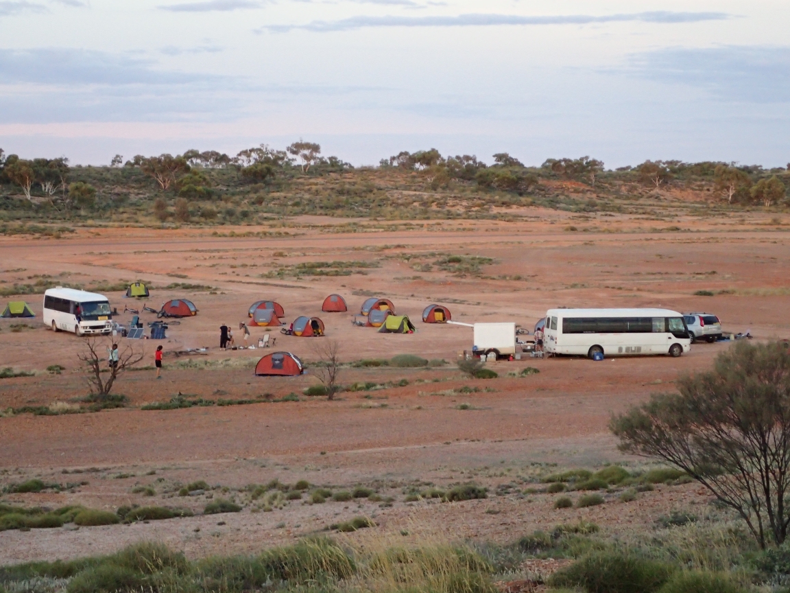
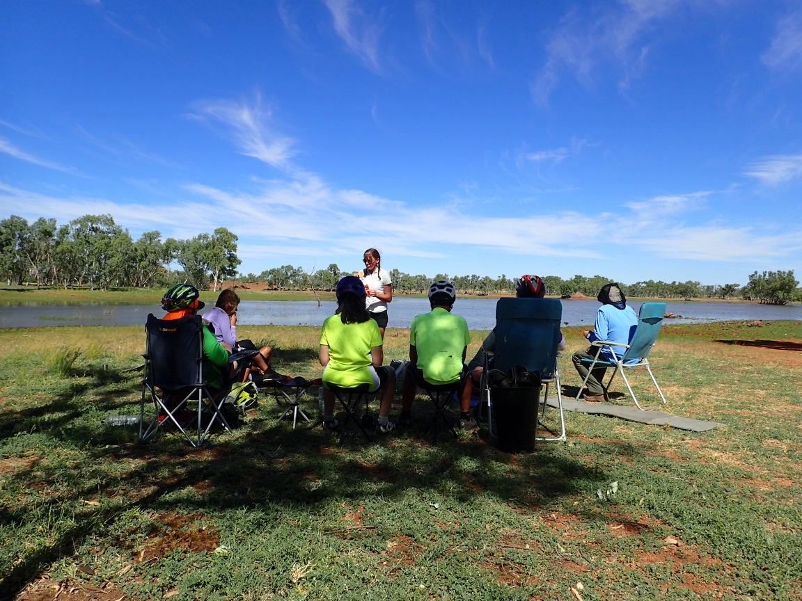
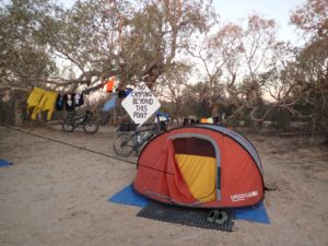
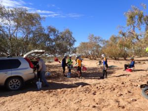
We are camping roadside this evening at a somewhat public facility halfway between Cloncurry and the Burke and Wills Roadhouse 186 kilometres from our start. It seems to be a very popular place for the camp for free crowd. At least six vehicles with caravans (trailers) have pulled in and another three or four having taken a look at our 19 tents and decided to move on. One resident who did not mind our being here was a large and colourful spider that Niels found nesting in a nearby tree. As the Crocodile Hunter used to exclaim, “What a beauty!”
Gold Globe spider
More tail wind on May 31st all the way to the Burke and Wills Roadhouse. The Burke and Wills Roadhouse is one of those places that owes it existence to being right in the middle of someplace and someplace else and just far enough from both to be a good place to stop. Aside from the roadhouse and camping area you alternatives are strictly limited.
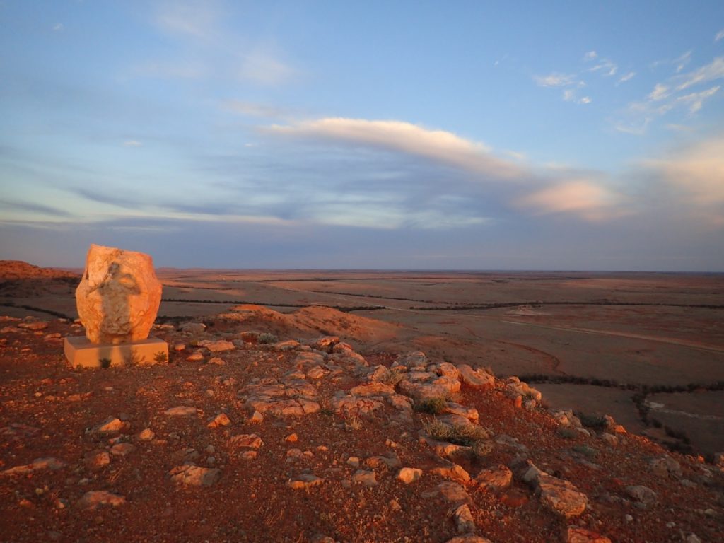
Monument to the Aboriginal peoples who once owned this land
The road from Mount Isa to Cloncurry, 120 kilometres east is a busy road. Not with rush hour traffic but with industrial strength traffic. You want to see road trains? Here be road trains. You want to see drilling rigs, construction vehicles, delivery vehicles, vehicles to service all of the above? You can find them here. Toss in a few happy vacationers and their caravans and you may get the picture. The scenery along the way is breathtaking, when you can dare to tear your eye away from the mirror to watch it. After many days of riding the seldom travelled Outback roads, Route A2 to Cloncurry takes some adjustment in your riding habits.
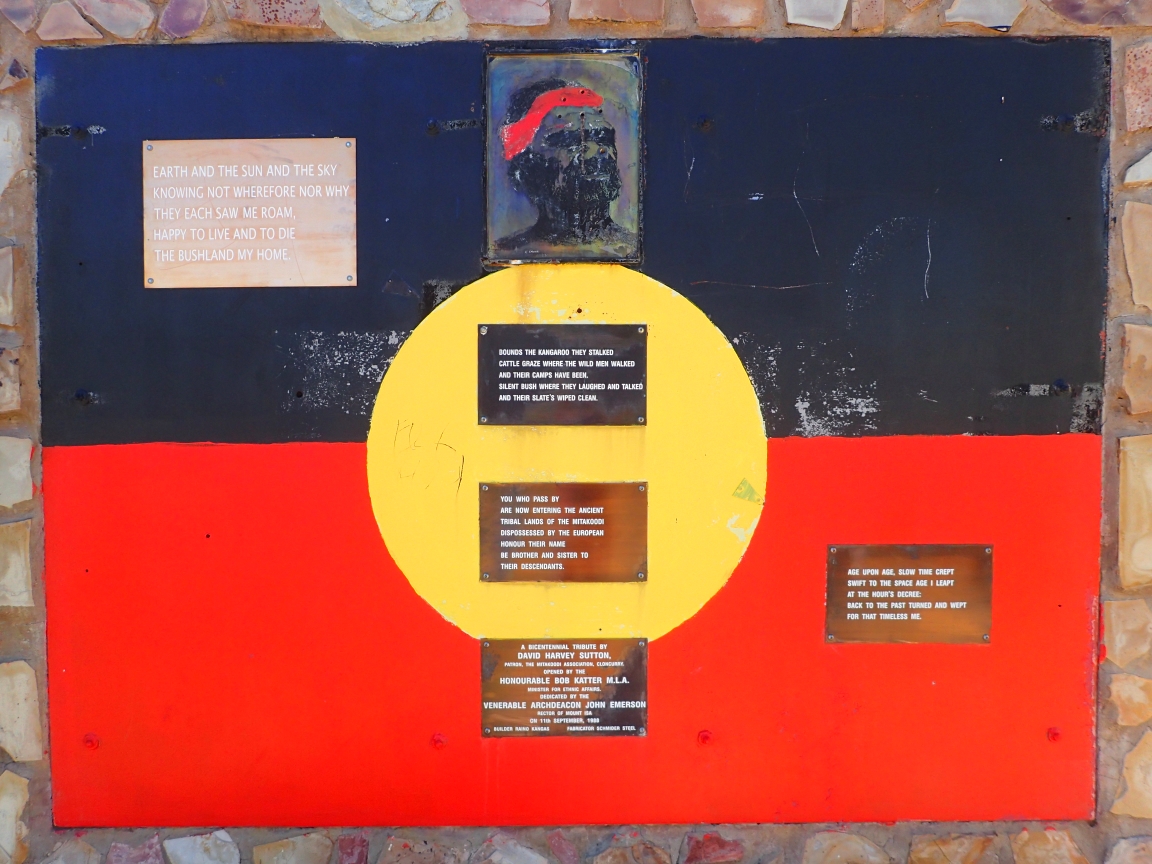
The road passes through the ancestral tribal lands of the Kalkadoon and Mitakoodi peoples. They were dispossessed of these lands by the European settlers who came with the opening of this continent. There is a monument to these people who’s descendants are still part of the Australian culture even though they are a people without a homeland today. It reminds me our some similar circumstances back in Ontario and the impossible task of righting these wrong doings that still live fresh in so many memories. There are no easy answers and no way to turn back the pages of history without creating another wrong in the process. This monument is a reminder of work that still needs to be done. Here is a poem that is part of the monument:
Earth and the sun and sky
Knowing not wherefore nor why
They each saw me roam
Happy to live and to die
The bushland my home
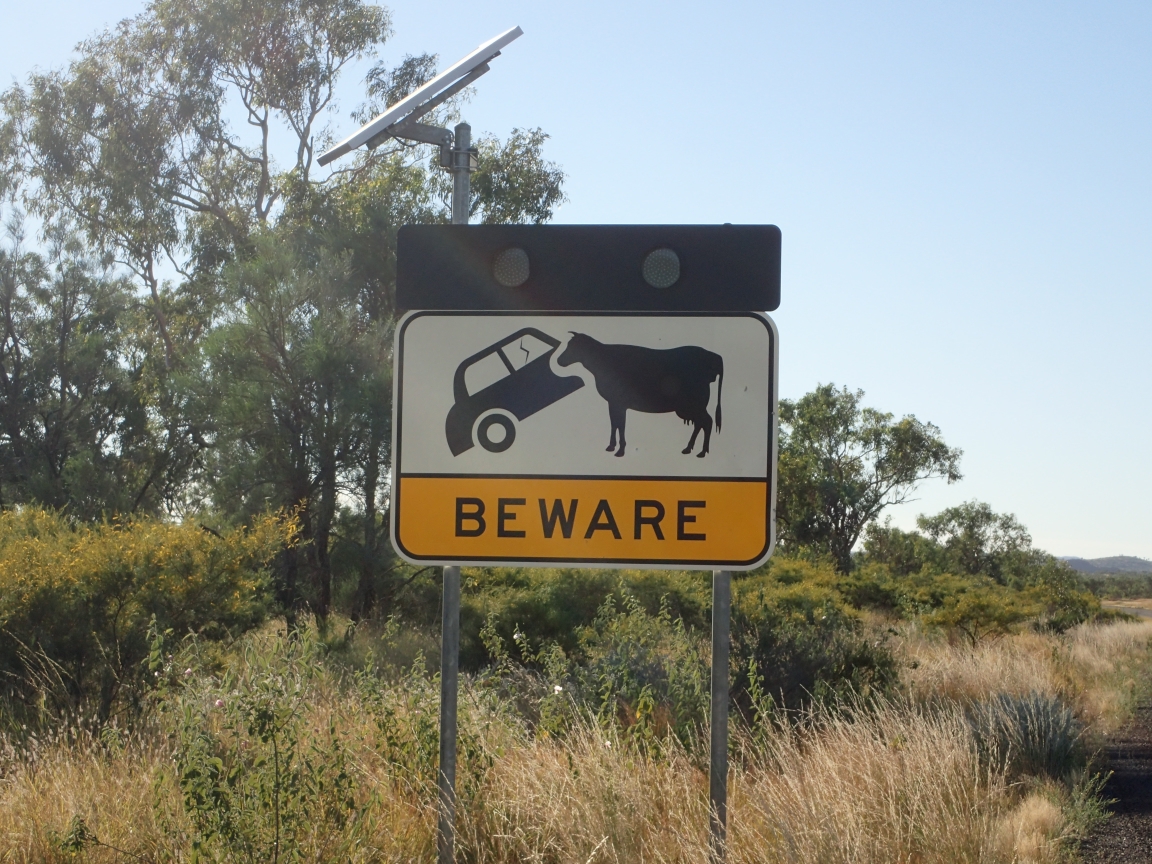
Just what are they feeding these cows?
There were a couple of interesting road signs along the way today. The first involves a cow and a car. It sends a couple of different messages. Should we fear attacks on our vehicles by the cows? Does it warn of some strange milk transport vehicles that may be on the road? Maybe it warns to be on the lookout for hybrid vehicles? Whatever it is saying, I plan to give any cows or cow like objects that I see plenty of room.
I did not get the message.
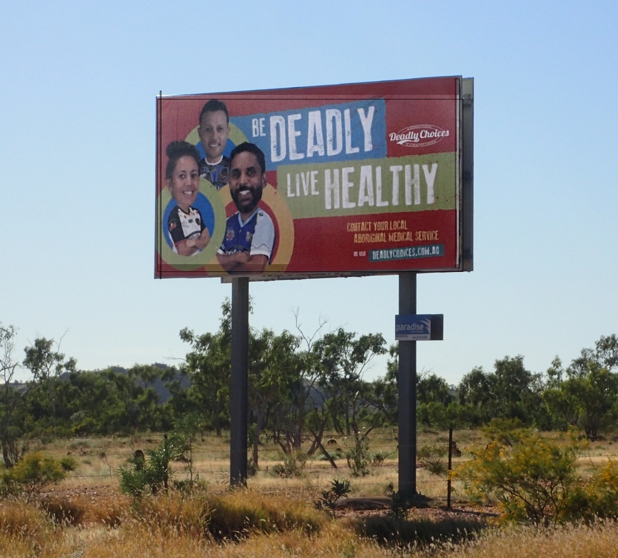
The other sign was a billboard that advises us to, “Be Deadly, Live Healthy.” I’m not sure just how this works. Sure, I can live healthy but why should someone else have to die because of it? Maybe it is some Australian thing that Canadians or at least I just don’t understand.
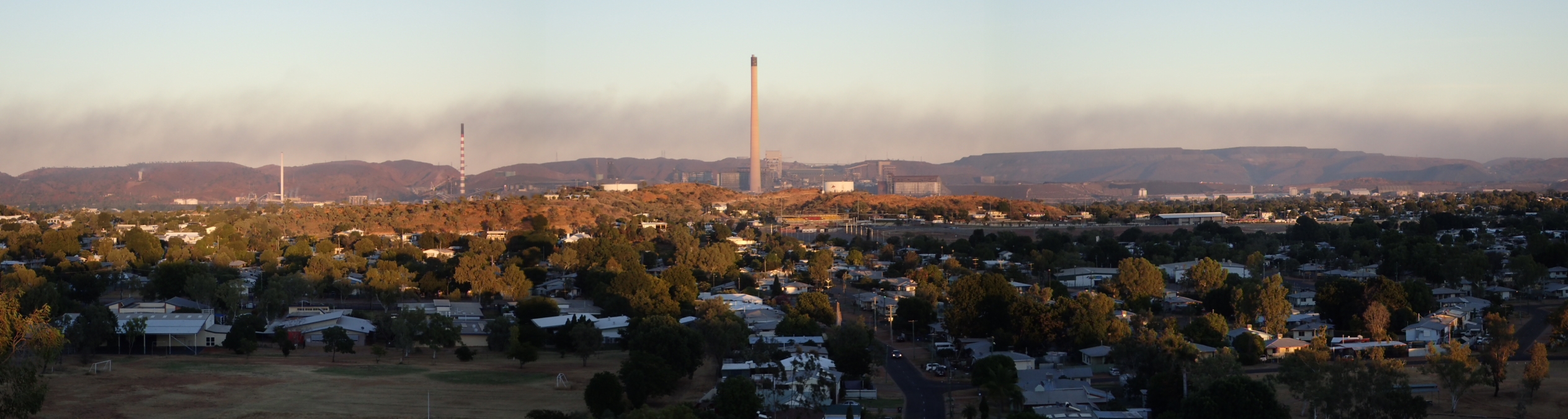
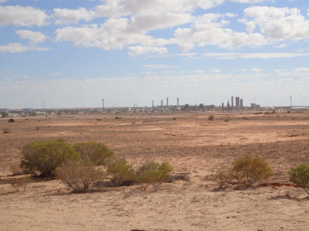
At first look Mount Isa is a beer and steak kind of town. Hard, industrial and everything has to have a function. A place to work, sleep, eat and little more. However, there is a deeper Mount Isa. One that has a symphony orchestra, art exhibitions and museums. It is a town trying to be more than its mine and metal past while still embracing those industries. It is called The Big Smoke with affection by most Australians.
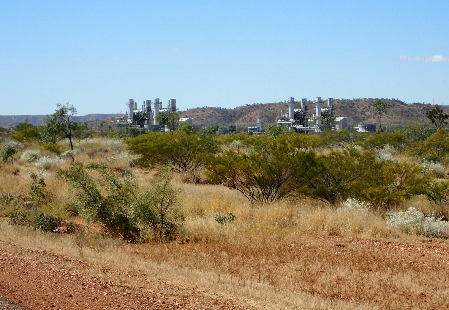
From whatever direction you approach this city its industrial base is first and foremost what you will encounter. Mines, smelters and the industries to service them definitely predominate. From the ground comes lead, zinc, silver and copper. Some is shipped away as ore and some processed into metals on site. The history of this industry is typical of mining in general with a chance discovery, early optimism, hard work and sweat leading to near failure before success was achieved. Today the mines are among the best producing in Australia.
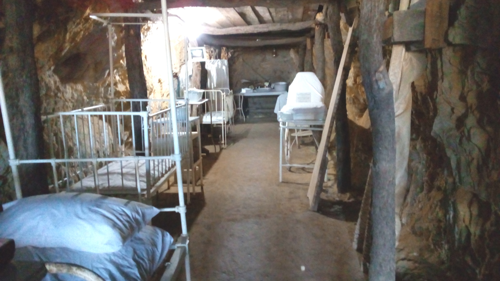
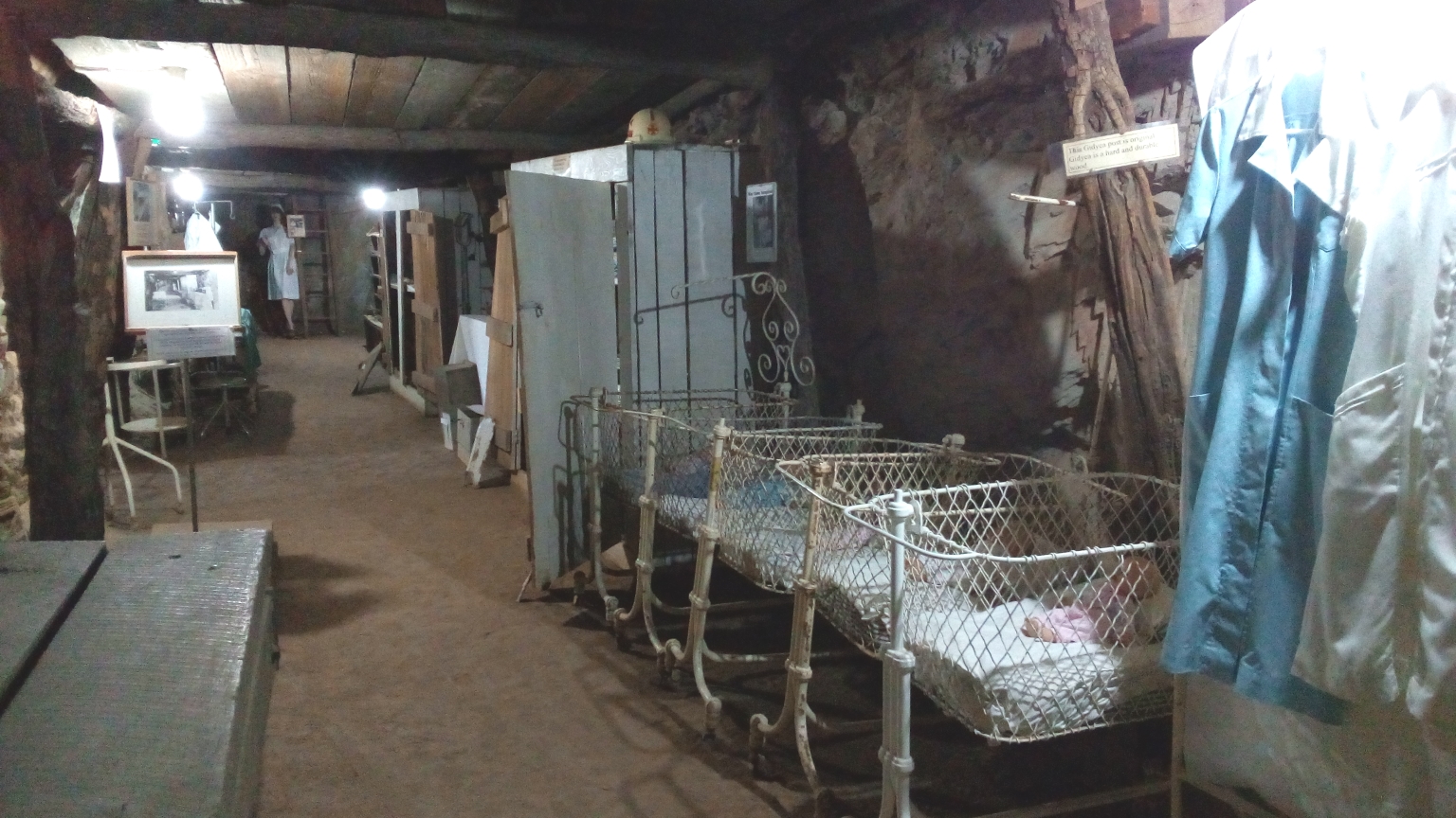
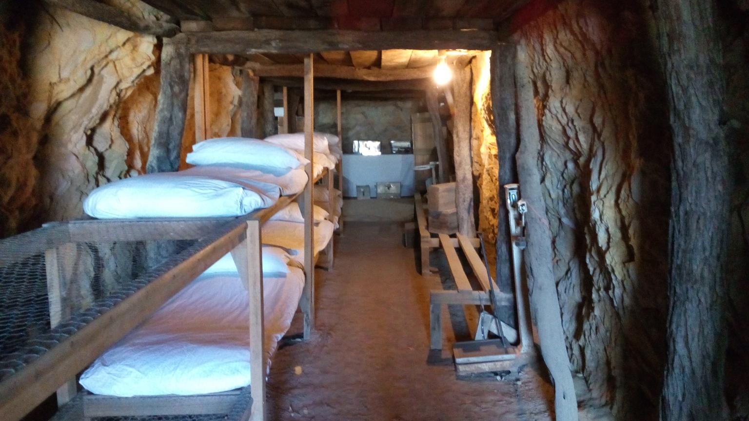
One of my visits was to the Underground Hospital Museum. During World War Two, Japan effectively cut Australia off from the rest of the world during the period when their navy dominated the Pacific Ocean. When they bombed the port city of Darwin, the inland city of Mount Isa feared attack as well due to their mining and metals industries. The hospital which was a collection of tents and small above ground structures on a hill top was especially vulnerable. Using help from the miners they carved out a series of tunnels below their hilltop that made the hospital invisible and bomb proof. While mount Isa was never hit by the Japanese, the underground hospital provided insurance of continuous medical treatment throughout the war. Today it has been restored to its war time prime to tell the tale of those fearful days.
Maternity ward in the underground hospital
Nurse’s quarters underground
Mount Isa is suffering from a population drop of about 30% over the past 20 years due to many workers choosing to live elsewhere and fly in for their work shifts. The mines and smelter companies promote this as a way of attracting the skills they need to operate in this near nowhere city. However, the city is fighting back by doing everything in its power to make this once beer and steak town into a place to live, raise families and retire. With the Outback on their doorstep they have plenty to offer and so long as the ore holds out, Mount Isa will fight on.
Today we hit the last leg of our segment from Boulia to Mount Isa where we will stop for a rest day. The wind kicked up overnight and was strong enough to cause the sides of my tent to slap against my head. Nice wake up call. Packing everything down in the strong wind was a challenge but we managed by helping each other and preventing tents and tarps from turning into runaway kites. At least it was a tail wind for the first 35 kilometres or so. Later it was more in our face before finally becoming our friend again as the road turned to a more northerly direction into Mount Isa.
Entering the Shire of Mount Isa
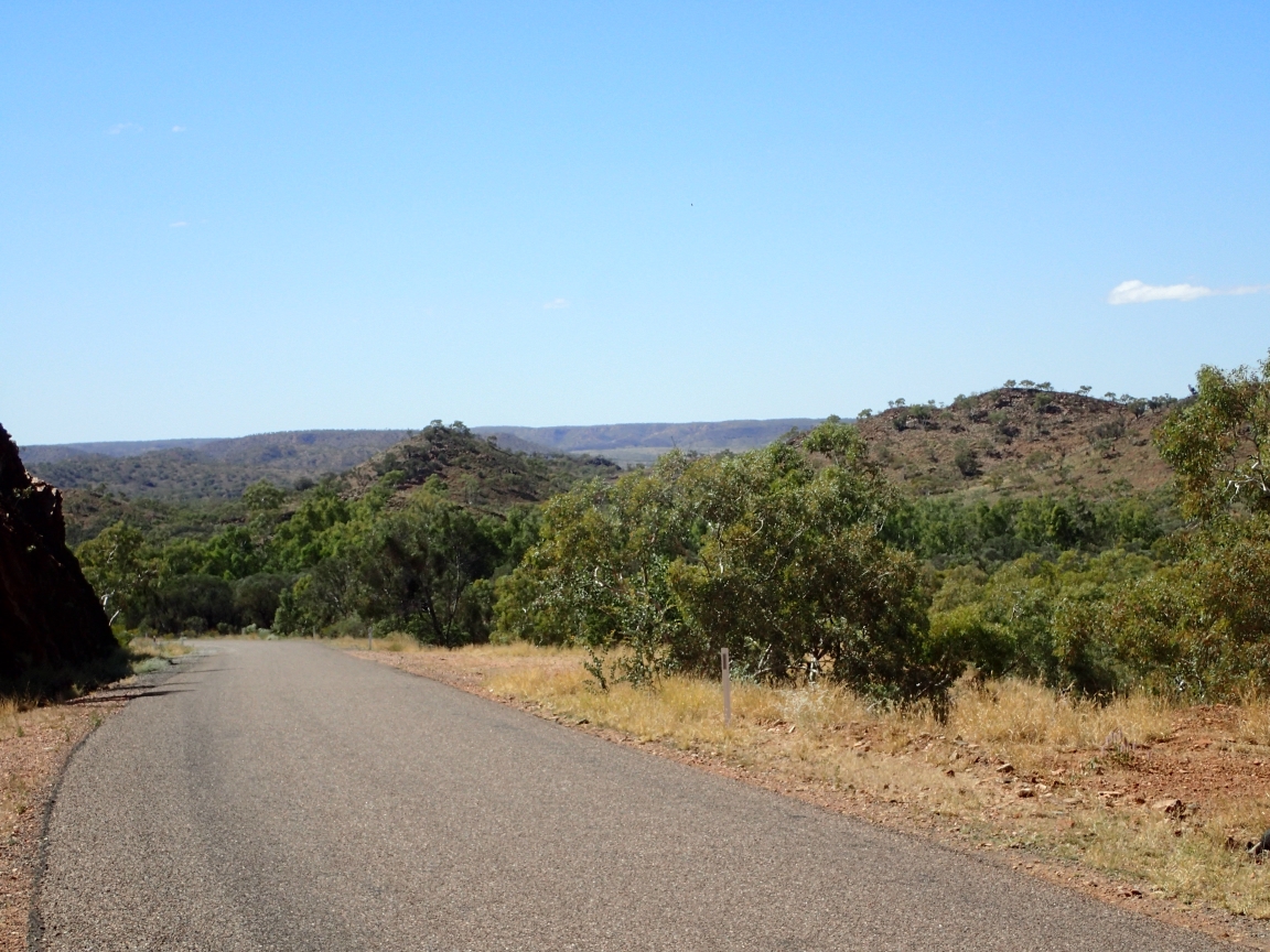
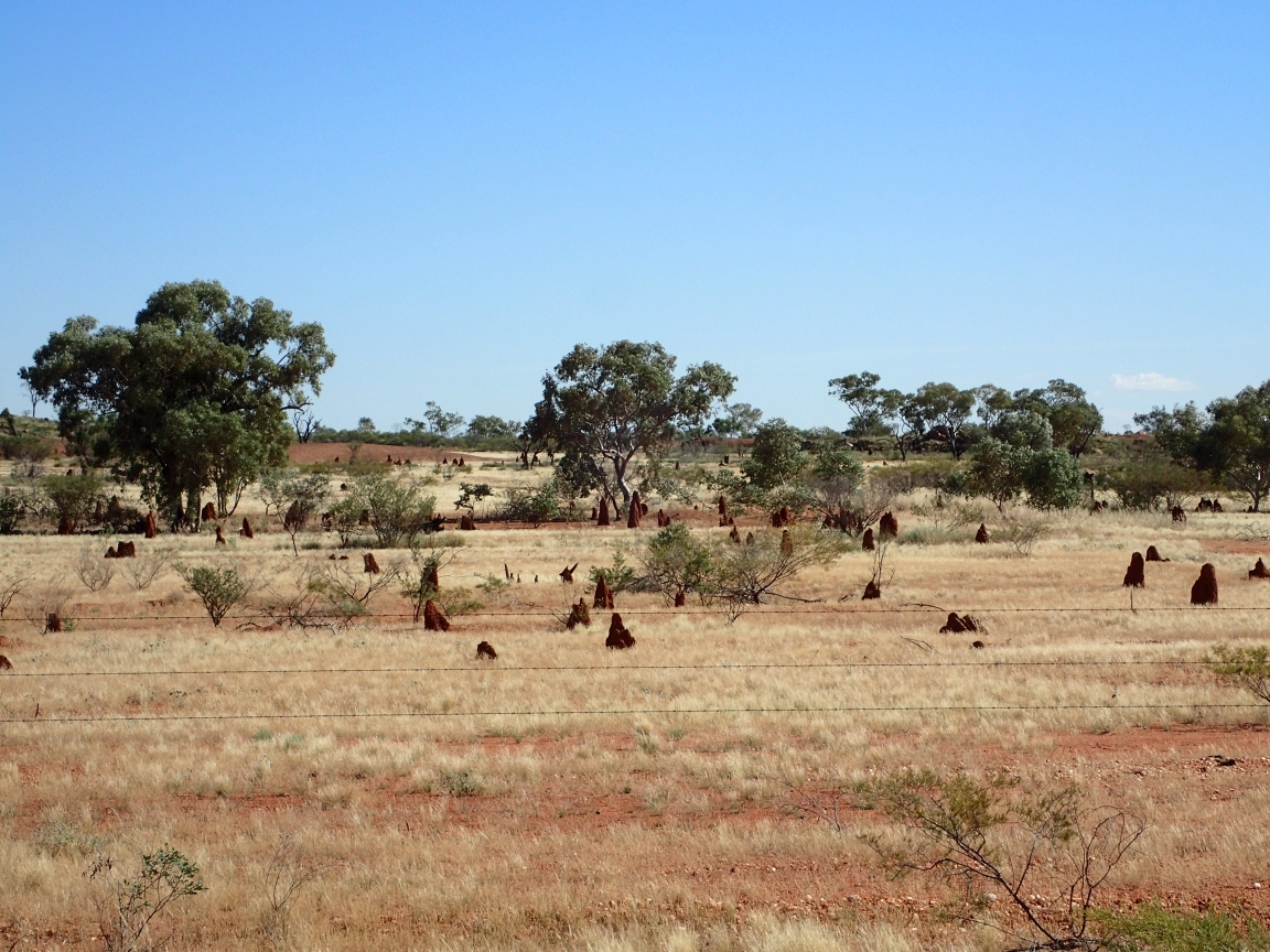
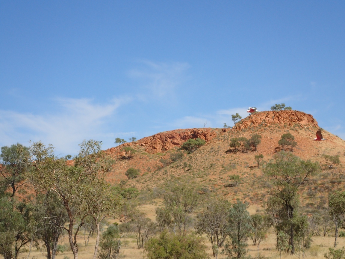
While the Shire of Mount Isa is a lot less than what I think of as mountainous, it is quite hilly and a change from the flat, dry Outback we have been crossing. Boulder abound as do large termite mounds. These termite mounds dominate the landscape in some areas with their cone like structures forming large colonies of these wood eating insects.
Termite mound
Termite colony
From the beginning I had a mental picture of Mount Isa as being somewhat resort like with plenty of trees and shady streams running down steep hillsides. What I found was an industrial centre of mines, smelters and heavy industry. It is a busy place and definitely the largest town we have been through since leaving the southern coast at Port Augusta. The town is suffering a downturn despite the thriving mines and smelters. Many of these companies now fly their workers in from other areas c=reating a Monday through Friday transient economy. The number of permanent residents has seen a steady decline over the past decade and now stands at about 20,000 people.
Mount Isa industry
Tomorrow I plan to visit the town, post a blog entry then sit back, relax and generally get ready for the final week long leg of our cross the continent journey. Starting May 29th we make our week long final push to the northern coast and Karunba.
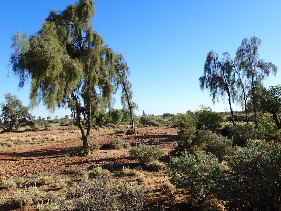
The last two days have been some of the most pleasant of rides for the group. The scenery has changed from flat desert to a landscape with more trees, more greenery and undulating hills. The winds have been softer and even favourable at times. Even the flies have backed off a bit but NEVER entirely. It has been a pleasure to be riding with every rider able to finish the days ride without feeling drained of all strength.
Promoting the Min Min lights
On the way out of Boulia I stopped to take a picture of the town’s primary attraction, an information centre dedicated to the mysterious Min Min Lights. These unexplained lights can be seen doing strange things in the distance a short ways out of town. My guess is that they are like the Marfa Lights in Texas or the Deacon Lights near home in Ontario. Most likely car lights or farm equipment lights that folks convince themselves as being some unexplained phenomenon. Imagination and suggestion are the primary ingredients. Either that or swamp gas.
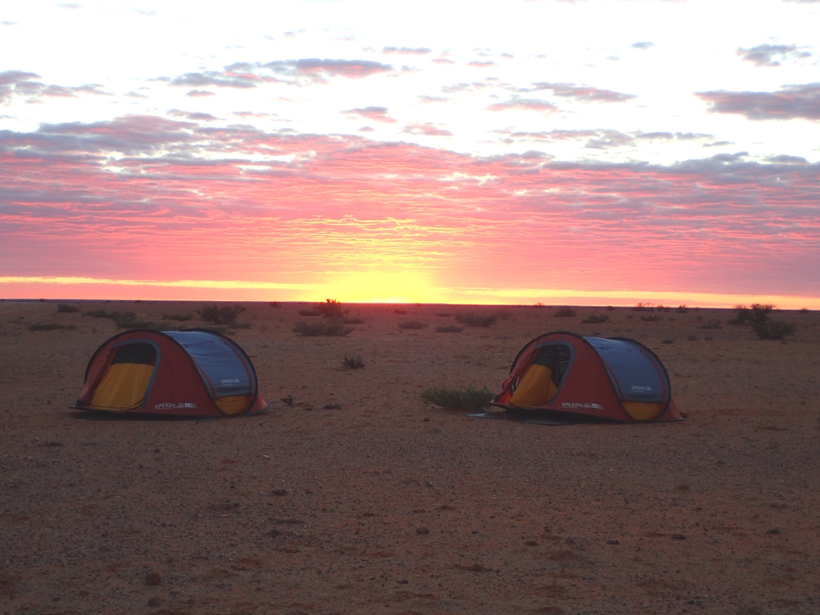
Our roadside Outback camp
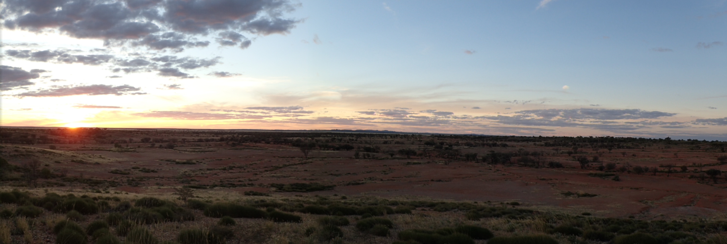
We left Boulia making an early start heading for a roadside bush camp site about 100 kilometres distant. This would be primitive camping with sanitary facilities being a hole dug into the cement hard earth. What the location lacked in amenities it made up for with a spectacular sunset view. Breakfast was the usual fight with the flies to see if I could eat my porridge before they got into my mouth.
Long morning shadows
Changing landscape
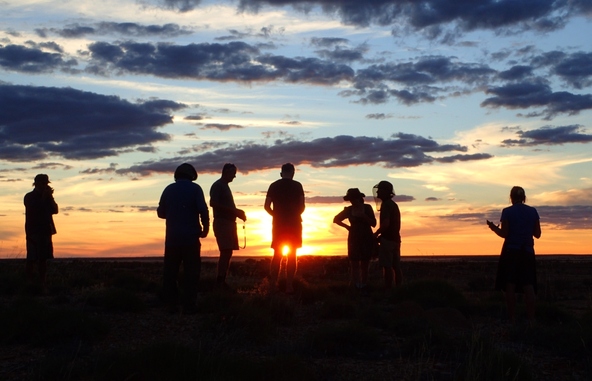
Gathering to watch the sunset
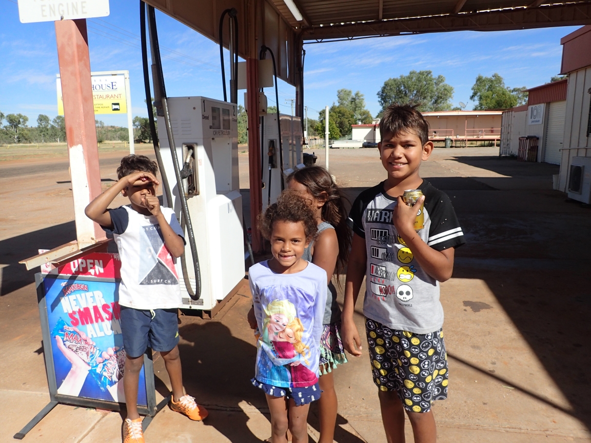
Sunday the 26th of May was another early start with everything apparently in our favour. Winds we expected to be at our back, the road reasonably smooth and our distance a reasonable 100 kilometres. Along the way we would be treated to a rare mid-ride town. In the Outback the distances between settlements can be a lot further than a day’s ride so having the prospect of a place to buy a cold drink along the way was a real treat for us. Dajarra did not disappoint. Even through it was a Sunday the local motel and roadhouse was open with an ice cold sarsaparilla to cool my throat. Dajarra is a largely Aborigional community that was once a major centre for the cattle industry. Cattle still play abig role today as they do across the Outback with jobs tending, hauling, rounding up and generally getting them to the table of hungry Australians. We met some local children enjoying a Sunday treat from the roadhouse. They were interested in our bicycles and where we were going.
Bush camp breakfast
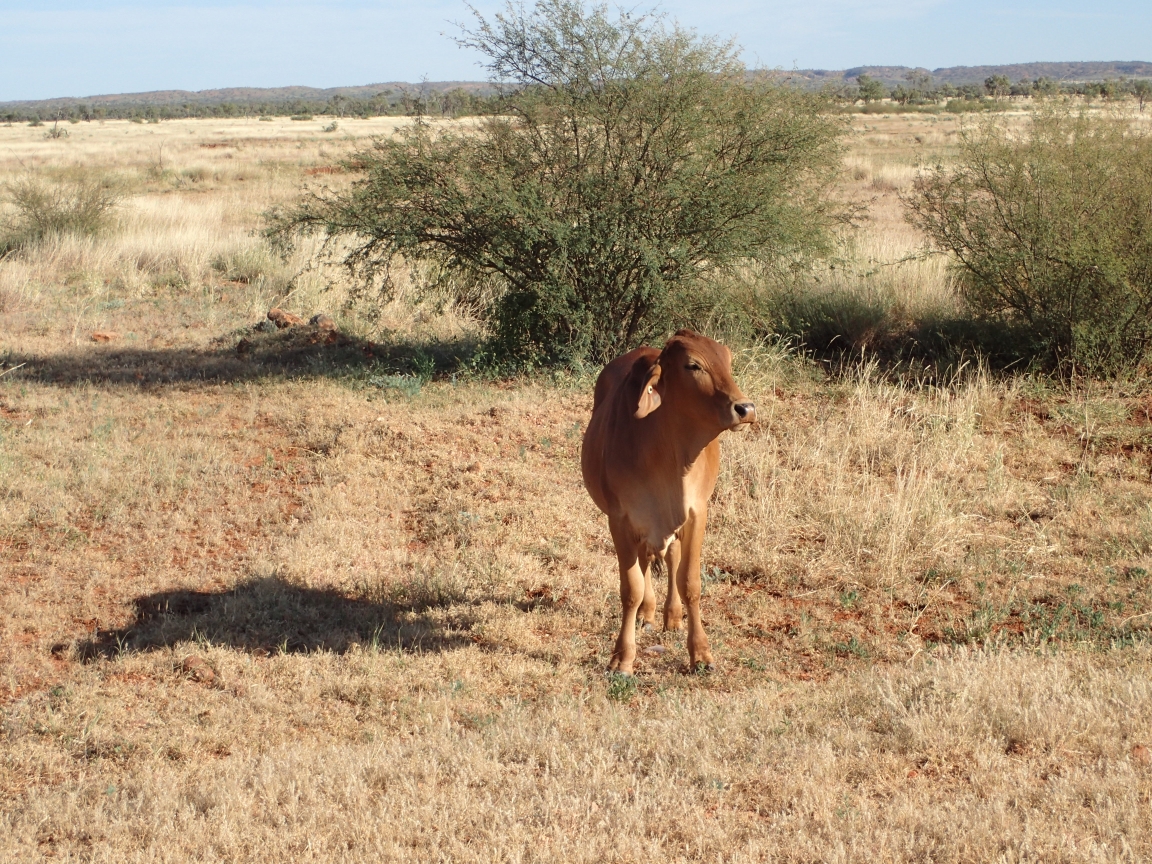
Cattle country
Local children in Dajarra enjoying a treat.
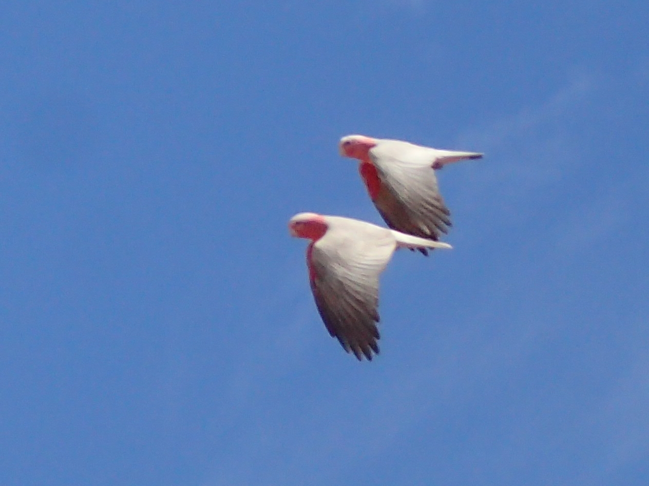
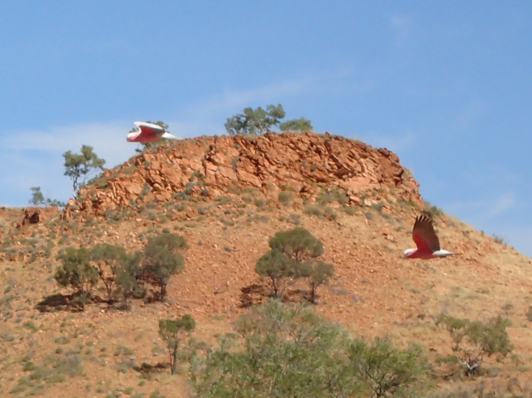
Lunch by the billabong
Our lunch stop was at a location that I think I can sum up by paraphrasing Paul Simon’s words from the song, Dangling Conversations: A real life watercolour on an idyllic afternoon. A cool, green clear water pond restfully shaded. Major Mitchell parrots swooped and soared over the water while we rested our legs and ate our sandwiches. It was the best lunch stop so far on the trip.
More Major Mitchells
Major Mitchell Parrots in flight
Our roadside Outback camp
With the landscape more varied now the kilometres seemed to drift by as we peddled our way over the last 40 kilometres to another rustic, roadside camping site. Break out the shovels and the TP for tonight; tomorrow we camp at Mount Isa.
Bedourie is much like the other Outback towns we have visited in that it is small, even by Canadian town standards. Most have had populations under 100, at least one hotel and caravan park, pub and as Mark Twain put it, “some talk of building a church.” It is surprising that towns of this size can financially support even this modest infrastructure unless you consider tourism. Tourism, as much as cattle and sheep appears to be the oxygen that sustains rural towns. These towns are some distance apart and each seems to try to make the most of whatever is has around it. I can personally attest to the fact the beer is properly chilled in each and every pub we have passed.
Crossing the line
Along the way today we crossed the Tropic of Capricorn marking the most southern position to receive the un-slanted radiation from the sun. Thankfully, those hot, direct rays are on the way north, above the Equator to the Tropic of Cancer where they will pause briefly and retrace their route south ending up again at the Tropic of Capricorn next September to mark the middle of Australia’s summer. If this were not so, our rides would be unbearably and even fatally hot.
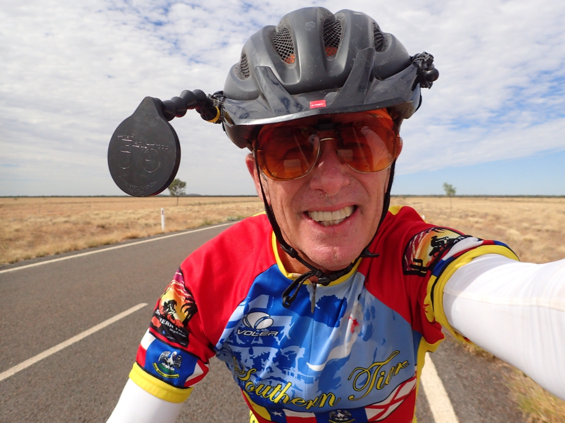
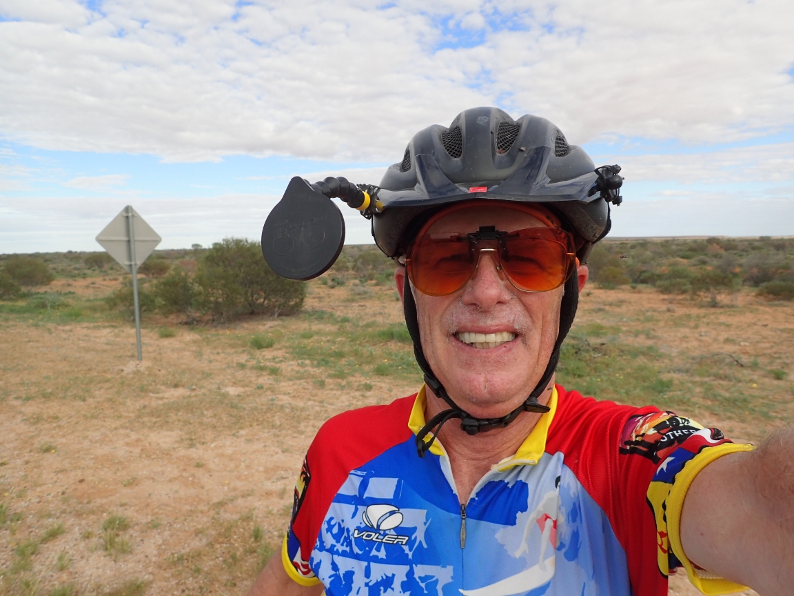
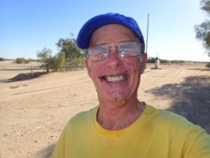
Roadside Selfie
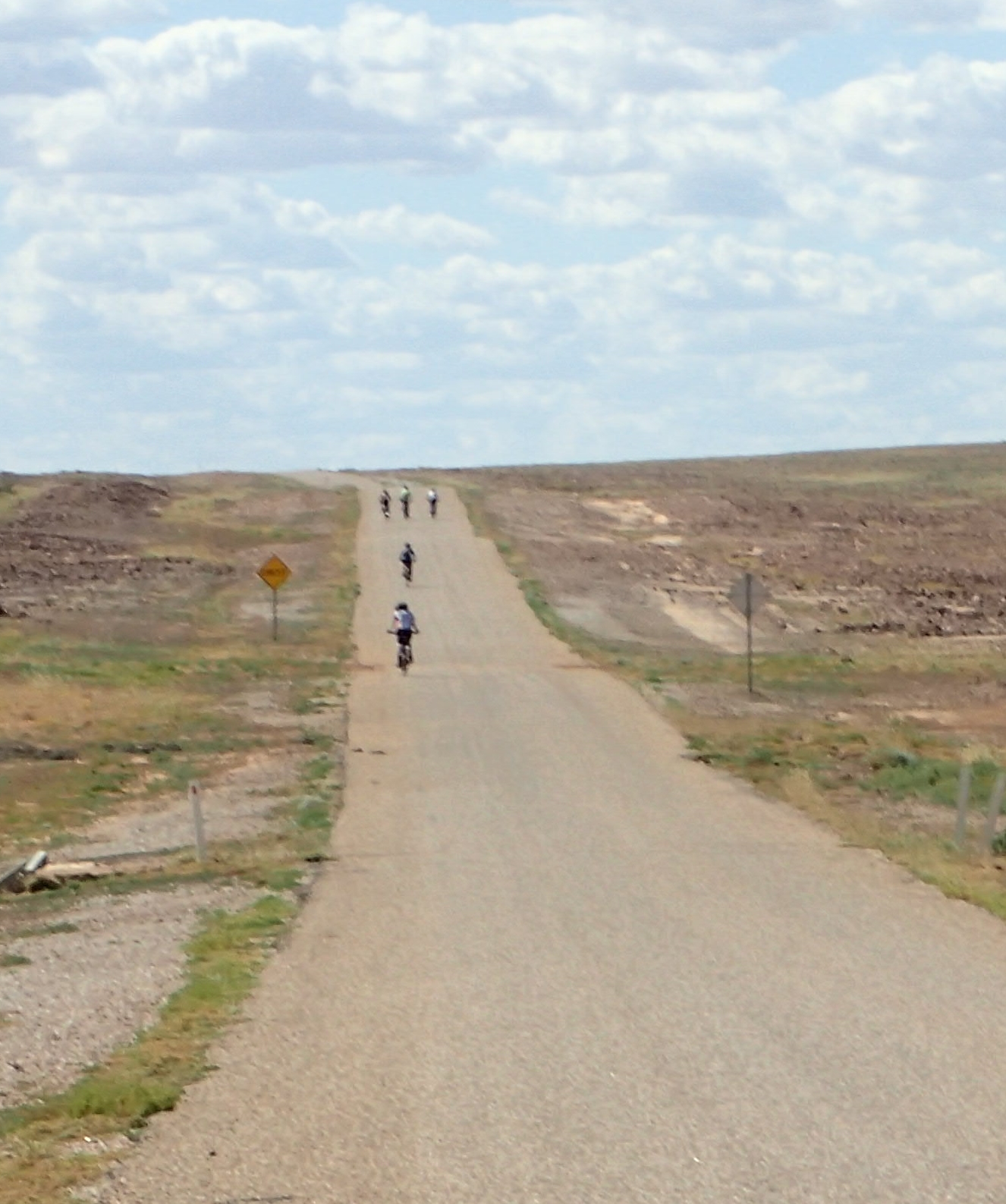
Riders on route
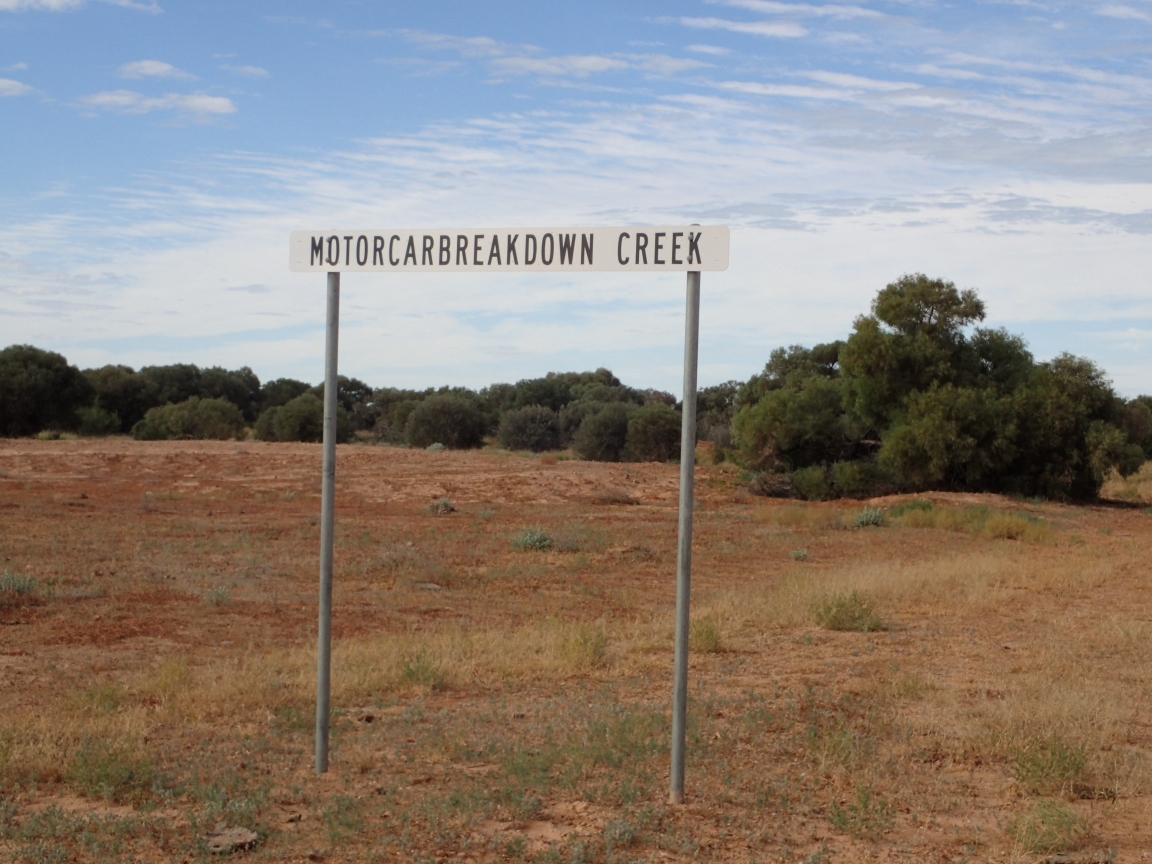
Motorcarbreakdown Creek
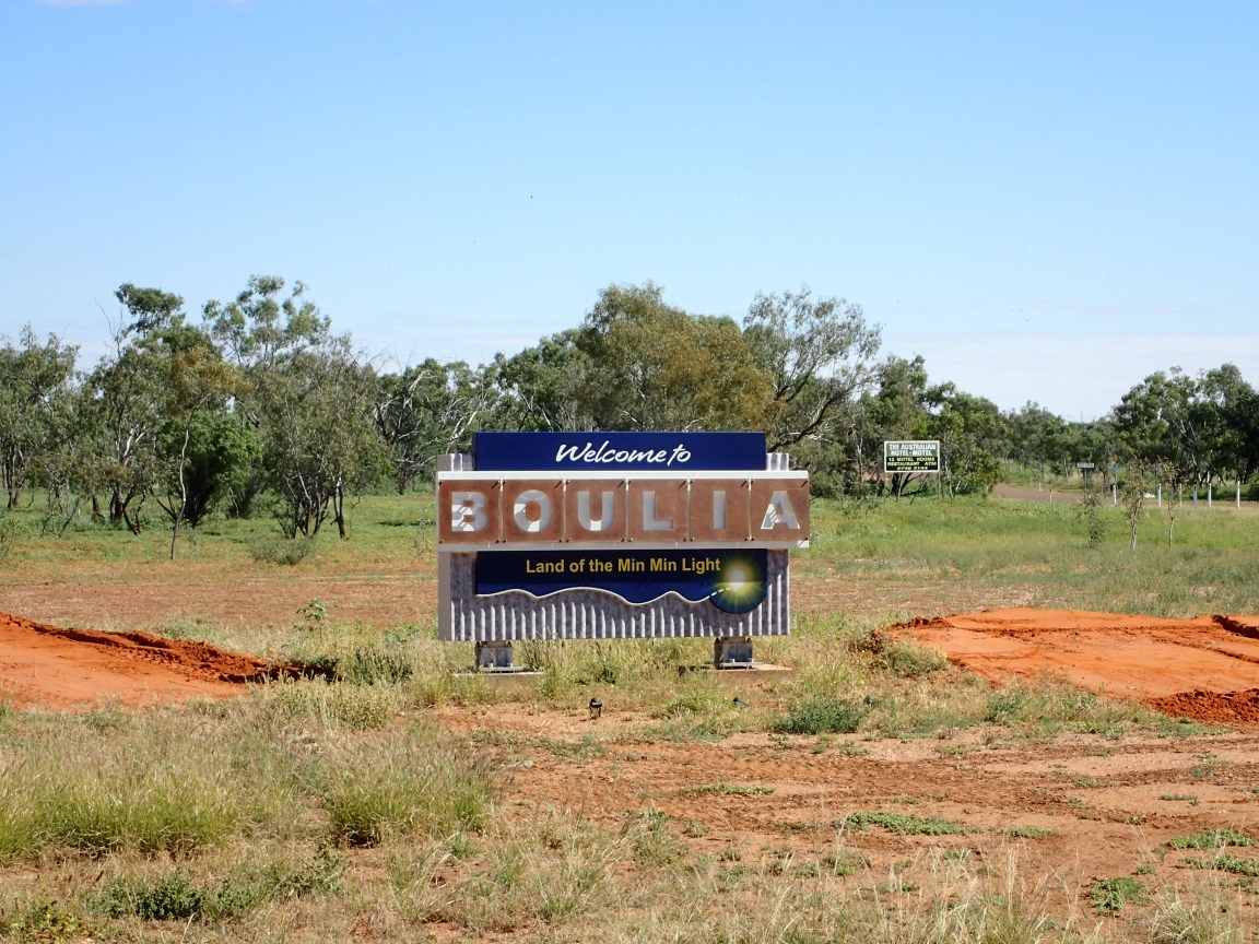
Camping tonight is in the desert again but there is the town of Boulia another 80 or so kilometres ahead. I’ll bet the beer is cold!
Boulia!
Boulia
May 24, 2019
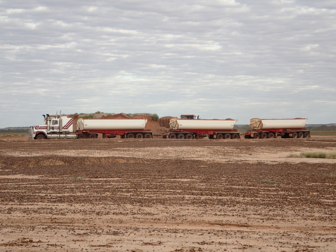
At last, an easy day’s ride! On seventy some kilometres of blessed pavement today, the wind be damned. Most of us took the option of an early start to take advantage of the cool, still morning air. The road now is paved for the rest of our journey with the exception of road construction. It was my misfortune to hit a section under repair just as two road trains rolled through raising clouds of dense, choking dust in their wake. Most road train drivers slow down for us aand othe vehicles on gravel sections but where the road is paved, it is warp speed please Mr. Scott. If you ar on two wheel you best be well over and stopped when they roll by at speed lest their draft suck you right off your bike.
Filling a road train
The rest of the road was an easy ride even with the wind turning against us. Still, I was hot, tired and sweaty upon arriving in Boulia. I wasted no time finding the local pub and ending my quest for that cold beer.
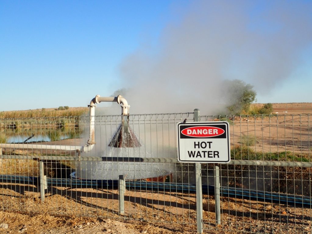
After a day to catch up on laundry and bicycle maintenance we were back into our saddles and on two wheels heading north for a 236 kms ride over two days to Bedourie. On the way out of town I passed the ruins of the old Royal Hotel which served Birdsville as a watering hole for thirsty cattlemen as well as a place to stay before the Birdsville races became a major, national event. Today it awaits preservation and restoration. Also on the way out of town we passed the water plant where Birdsville taps into the hot underground water that comes to the surface under force and near boiling hot. The energy is harvested to supply the town with 40% of its electricity and all the hot water anyone would care to use.
Birdsville’s underground energy supply
The Old Royal Hotel Birdsville, Queensland
Remove your shoes before entering Birdsville
Further up the road rest the Waddi trees, a rare and interesting species native to the Simpson desert. These trees can live up to 1000 years and are fire resistant. The wood is incredibly dense and hard enough to damage an axe head. Aboriginals would often use it to transport fire from one location to another.
Ancient, fire resistant trees that are rare and hard as iron.
The road on thee first leg of this segment was a mix of gravel and pavement with gravel predominating. It was a long hot grind to our roadside camping spot in the desert. Adding to the pain was a detour the blocked our route just as we came to end of the gravel. Due to flooding on the main route another 90 kilometres of gravel awaited us the next day.
The ride that day was as expected, a real gravel grinder. At least the gravel was well graded and had little to no wash boarding. I decided to make an early start to avoid the stronger easterly winds that would be mostly head winds until the road turned to the north. Lake Mahattie is quite large and the detour around it added another 40 kms to our journey. Eventually the route turned to put the wind most at our backs and we were able to make better time to the much greener lands around Bedourie.
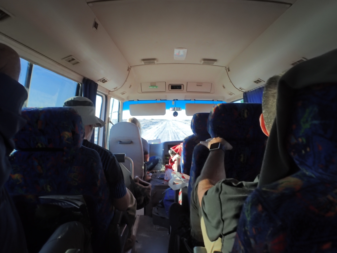
It was a disappointed crew that boarded the bus this morning to erase the hard won kilometres of the past three days as we travelled the bumpy Birdsville Track back to Marree and on to Lyndhurst where we would spend the night. Today would be 279 kilometres of rough, rattling, bus beating roadway with a fine dust that seemed to leak into the bus through every crack or opening. The experience is much like driving down the railroad track on the ties with dust for dessert. The rear door alarm was the first casualty followed by the exhaust system coming apart. Our electrician rider, Paul snipped the necessary wire to silence the first while Ralph and Andy fished a strap around the exhaust pipe to hold it nearly in place. The cover plate that rattled off the floor was only a minor annoyance. Dinner was a fine affair at the Lyndhurst Hotel with plenty of cold beer and wine to cut away the dust of the day. Camping that night was in an area that revealed itself to be a kangaroo toilet when the sun came up. Ah, the good life!
Canadian backwoods craftsmanship
The next four days were more of the same. More dust, more bone rattling, bus breaking, corrugated dirt roads and no air conditioning. The latter would not have been too bad except that the ever present dust made it a choice between choking or sweating. We chose sweating. Even with the windows closed we were still getting exhaust fumes from time to time so when we stopped at Innamincka for the night I volunteered to crawl under the bus for a little Canadian backwoods exhaust repair. Two soup cans, a few hose clamps, some wire, muffler tape and finger cuts later we had a continuous flow of engine exhaust from headers to tailpipe, mostly and good enough.
The long roads ahead
In a land where roads are scarce, detours can be epic. Mungerannie to Birdsville. What would have been a four day, 309 kilometre ride on a bicycle turned into a 1230 kilometre bus ride from Purgatory. The Chuck Berry rendition of Shake, Rattle and Roll seemed to be ever present in my mind. There were some interesting things along the way to make the journey less harsh than I may have implied.
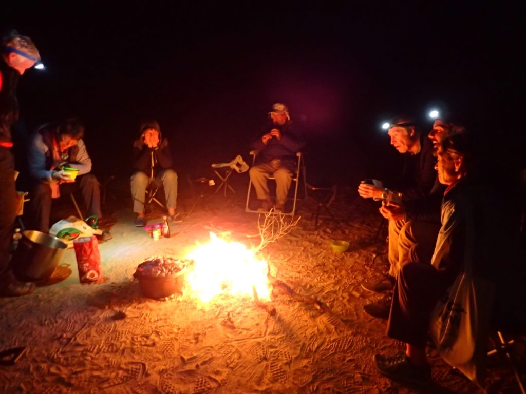
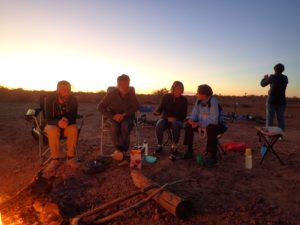
Friends around the campfire and everything is fine
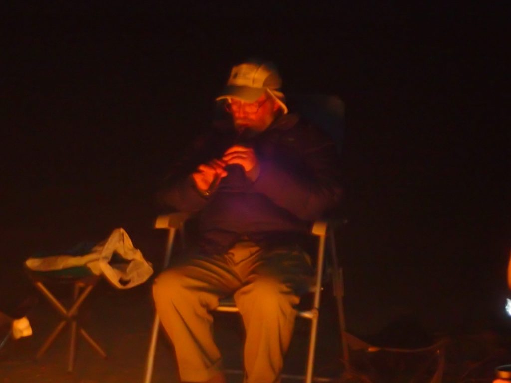
John supplies some tunes
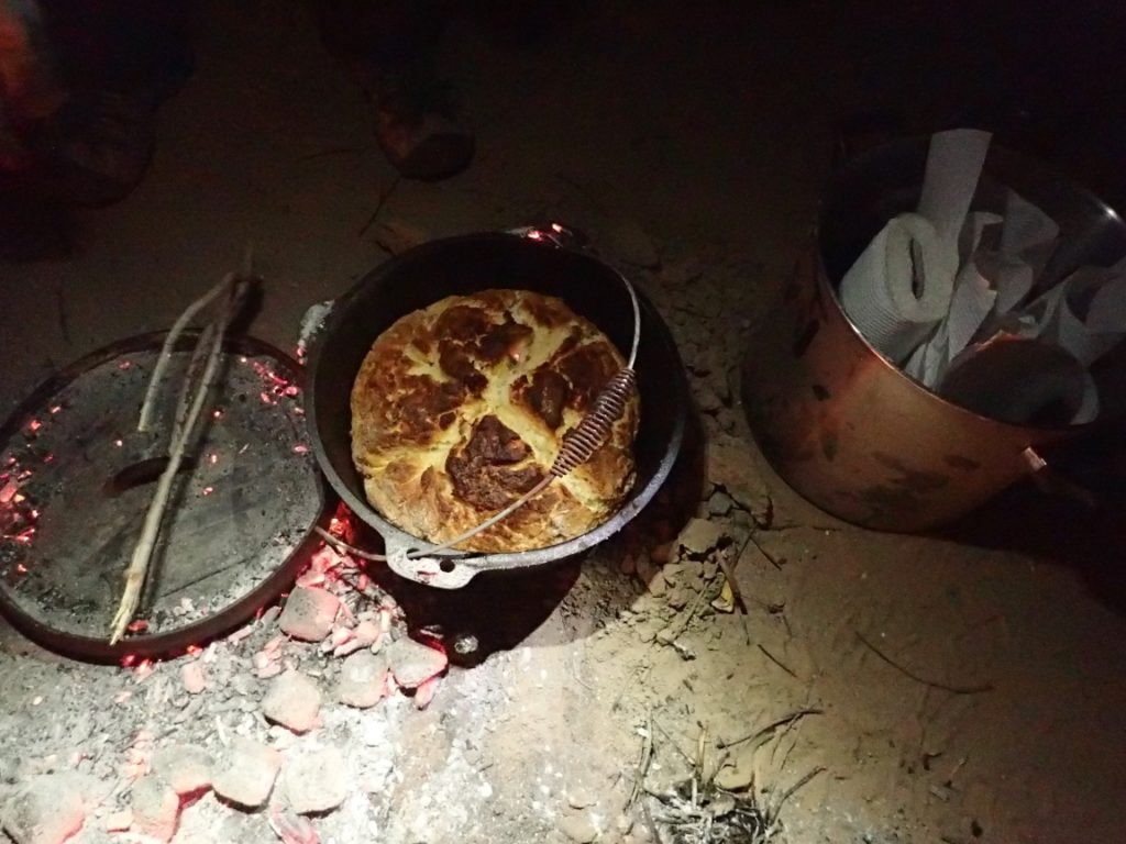
Damper baked on the coals
First of these was the fellowship of the road. Between nowhere and anywhere lives somewhere, where, as it happens, you happen to be. When you look around and take inventory you find that good travelling companions help to make any experience enjoyable. If we were not team of jolly companions before the ride we were one at the end. All pitched in to make this long and dusty detour one that was lighthearted and endurable.
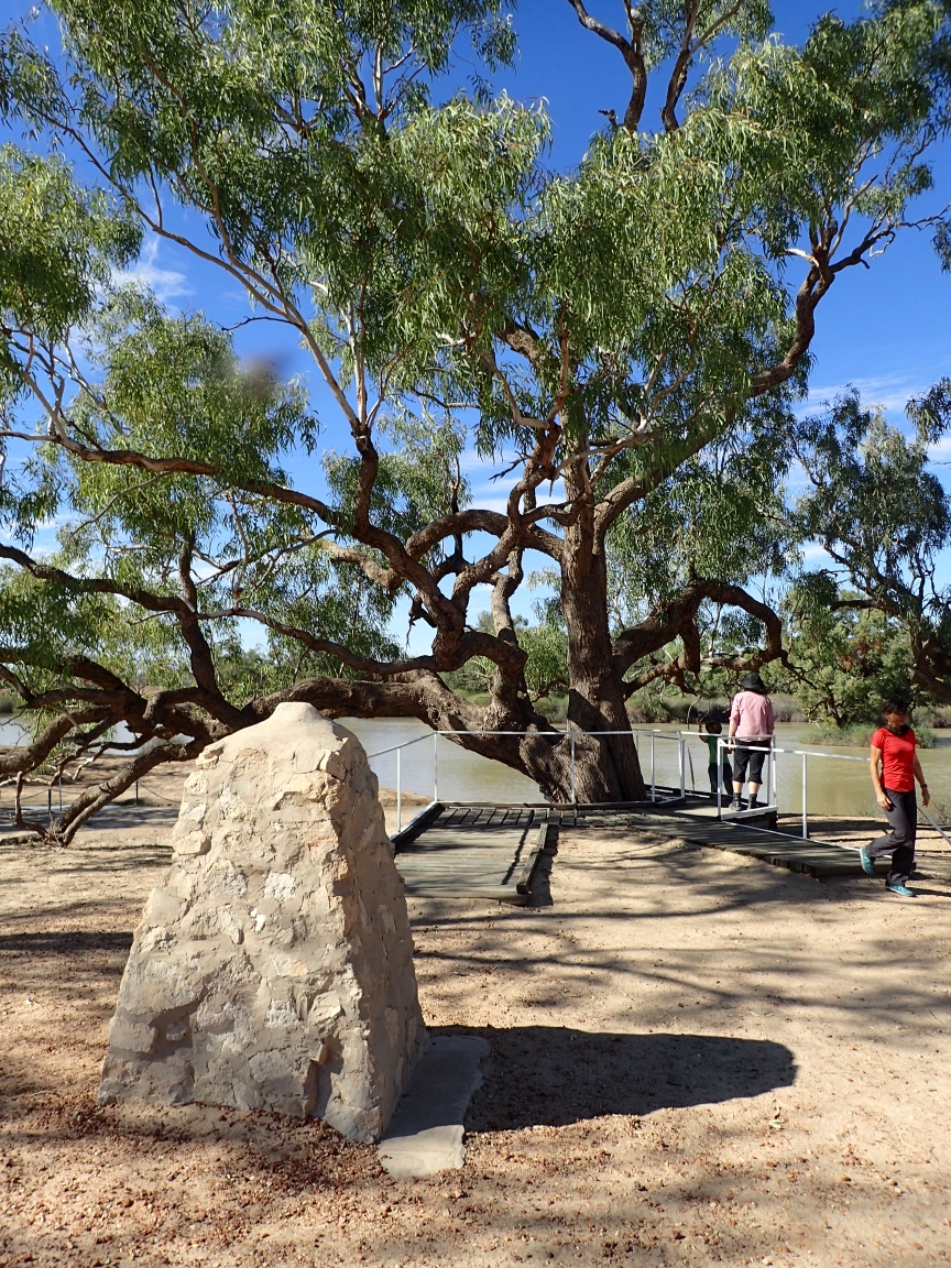
The Dig tree
Another was a visit to the Dig Tree, site of one of Australia’s most tragic and ironic events. Wills and Burke were two explorers who took up a challenge to cross Australia from south to north. It is a story of mistakes, confusion and ironic missed meetings leading to the deaths of both Burke and Wills at Cooper Creek in 1861. On the way north the expedition divided with a party left behind at a stockade they built at Camp 65 near Cooper’s Creek. As Burke, Wills, King and Charles Gray rushed north to the gulf, William Brahe was left at Camp 65 along with abundant supplies and instructions to wait at least three months or four if possible for the other party to return.
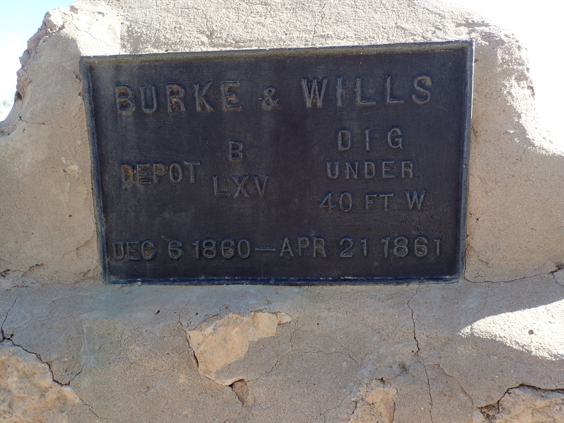
Burke and Wills marker
Burke, Wills and King made it to the gulf by February and headed back towards Camp 65. Charles Gray died on the return trip. However the journey took longer than expected and after waiting more than four months for Burke and wills to return, Brahe abandoned Camp 65. before leaving he burried a large cache of supplies a few feet from a large coolabah tree and carved the instruction, “Dig” into the bark. A few hours later that same day Burke and Wills returned to Camp 65 just missing Brahe and his party. They found the Dig Tree and the supplies and not knowing they just missed Brahe decided to make their way west to Blanchwater Station near Mount Hopeless.
Meanwhile, Brahe met up with Wright and his party of explorers and made the decision to head back to Camp 65 to look for Burke and Wills. Upon reaching the camp and finding no trace that Burke and Wills had been there they decided to go back by the southern route. Why they did not check to see if anyone had dug up the cache of supplies remains a mystery. Burke and Wills ran out of water before reaching Mount Hopeless and dies an ironic death in the Outback a victim of misadventure, miscommunication and just plain bad luck.
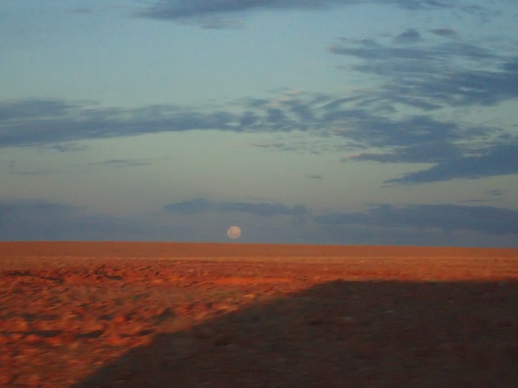
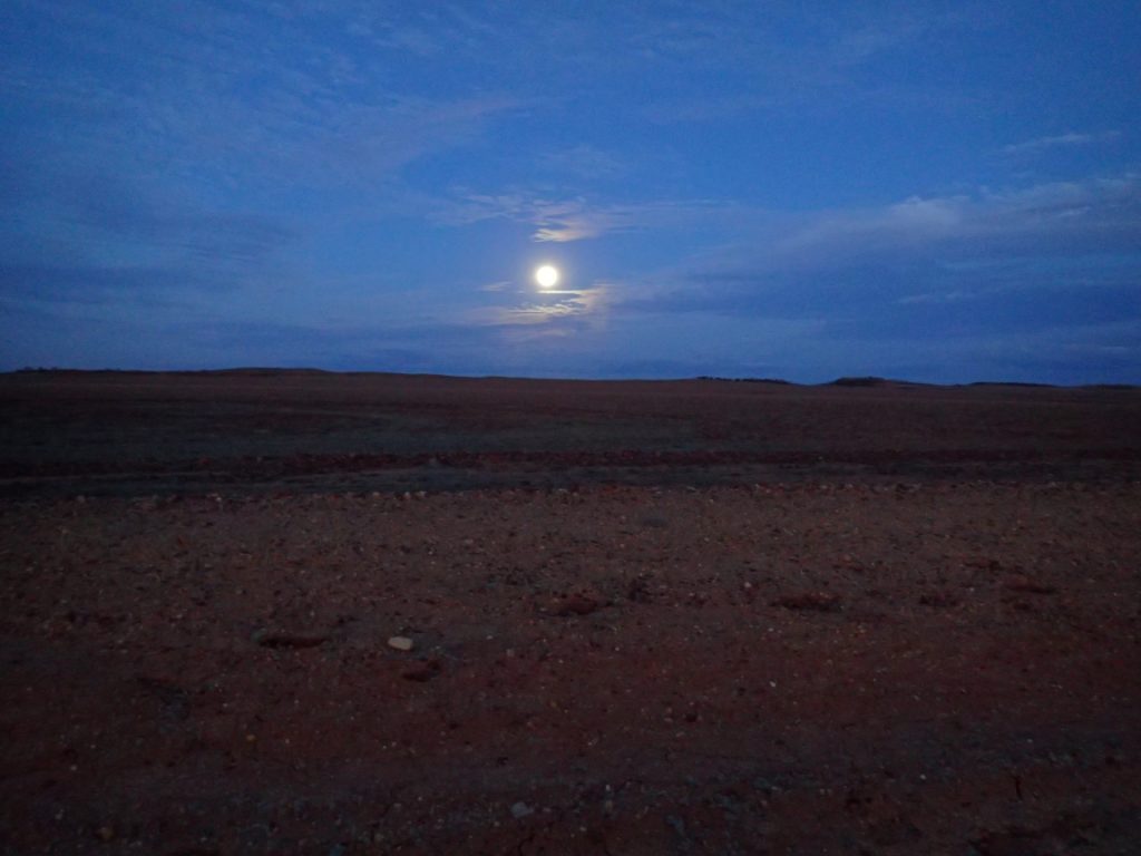
Giant gas plant at Moomba
Moon rise over the desert
Desert moonlight
Aside for the beauty of the desert there were some things to see. The huge gas extraction plant at Moomba, Deon’s Lookout, The Dreamtime Snake along with the occasional flood plain as we neared Birdsville. It was one of these floodways that finally get the better of our cheerful and enduring driver Andy. Just a few klicks from our destination a minor misjudgment resulted in a major miring in the sticky red clay of a previously flooded porting of the road. A bit of digging, a tow strap and a good Samaritan with a strong four wheel drive got us back on to firm road and the last bit into Birdsville. Some of us kissed the pavement.
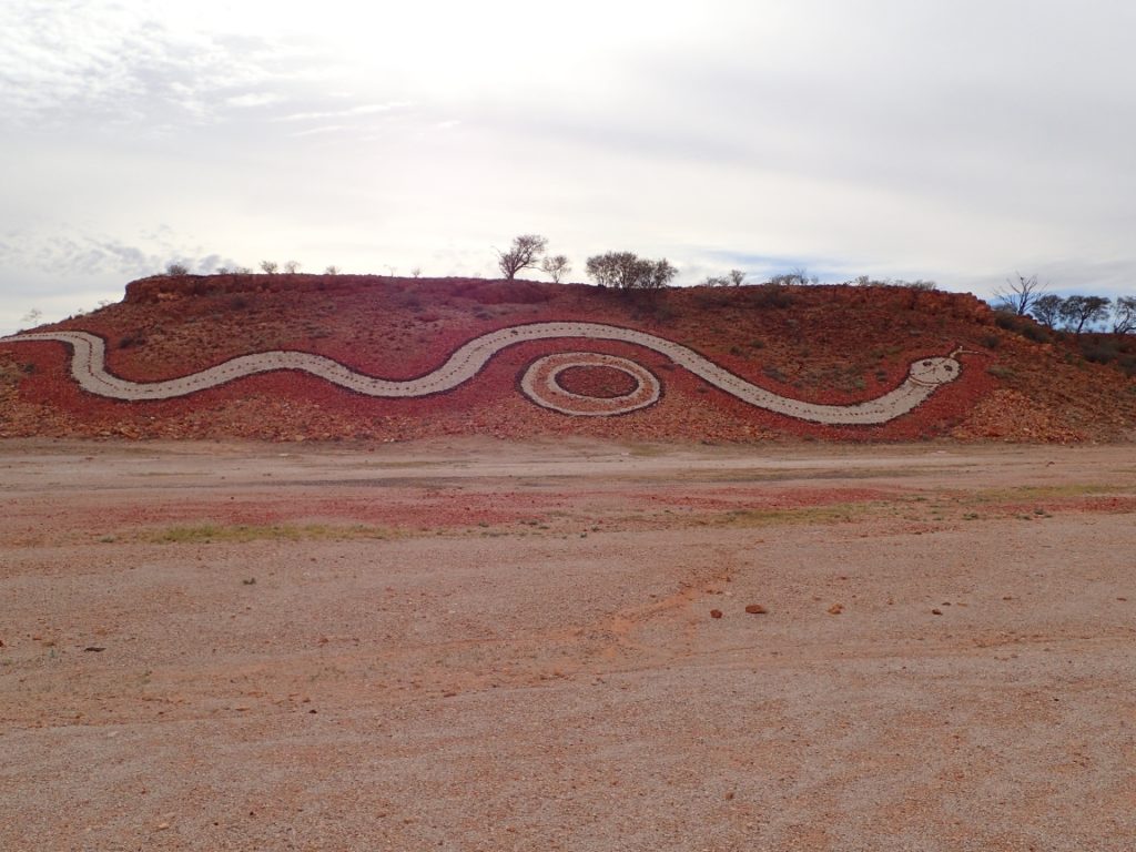
Deon’s Lookout
The Dreamsnake near Birdsville
Rusty kisses solid pavement
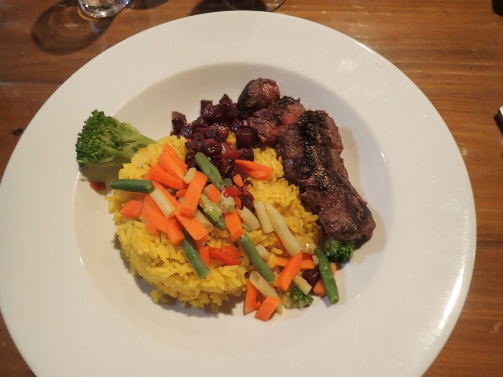
Later, once the tents were unpacked, the road dust washed away and a few moments taken to do some laundry, it was time to visit the Birdsville Hotel. Due to the many days without road access, supplies were limited and I had to settle for bottled beer. Oh, the humanity! Dinner tonight was a treat by Ralph and I had my first taste of kangaroo. It almost hops into your mouth!
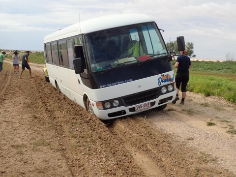
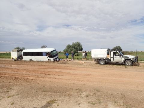
Stuck in the mud
Rescued
Kangaroo with a side of veggies and rice
Tomorrow I will spend my time getting the photos and blogs of the past nine days in order and on line so there will be no post for May 20th. May 21st, we are back on two wheels and off for the coast.
The Birdsville Track is an iconic route across the Australian outback. Once the domain of camel drivers and bullock trains it is over 540 kilometres of rough dirt, stone, sand and gravel road with services ranging from sparse to non-existing. Its most common visitors are the long road trains hauling cattle and sheep, four wheel drive adventurers and the denizens of the lonely cattle stations. Then there are the occasional hardy trekers on bicycles like us. As we left Marree we noted the sign said the road was open to Mungerannie but closed from there to Birdsville. We had a three day ride to Mungerannie and left with hopes that during that time the route beyond would open. A double barrelled flood event had washed out some sections of the road and created a five kilometre wide flooded area as we had some hope that we would be allowed to work our bicycles around the flooded area.
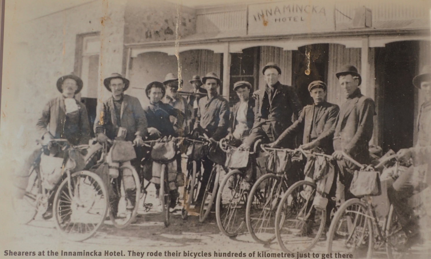
The bikers of yesteryear
The Birdsville Track is steeped deep in Australian history. Along its route Tom Kruse drove the royal mail through conditions that would have stifled a lesser man. Through these dry lands trekked Wills and Burke on their ill fated journey from coast to coast across the Outback. It is a goal today for many a four wheel drive, cattle station transport, vacationing caravaner and bicyclists such as us. The bicycling tradition in the Outback goes back many years to a time when transient sheep shearers would use them to ride from station to station during the time when wool was being harvested. Our goals are somewhat less ambitious as we will travel better maintained roads and have the luxury of vehicle support along the way.
Outback Hot Tub
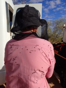
Our first night was spent at an oasis in the Outback where warm water from the aquafier gushed to the surface providing warm showers and hot soaking pool. Flies were everywhere and they swarmed our bodies, not biting but looking for moisture. They are one of nature’s more benign curses. Our shower was from the same hot subterranean source augmented with some cool rainwater from a tank above the shower hut. Unfortunately, when the cold water was turned the entire top of the hut leaked the cool water making it impossible to keep anything above head height dry. A solution was found by putting your dry clothing into a bucket and hanging it from the ceiling near the one dry corner of the hut.
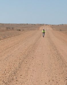
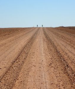
Lone rider on the dusty track
Rough Road
The dust of the track
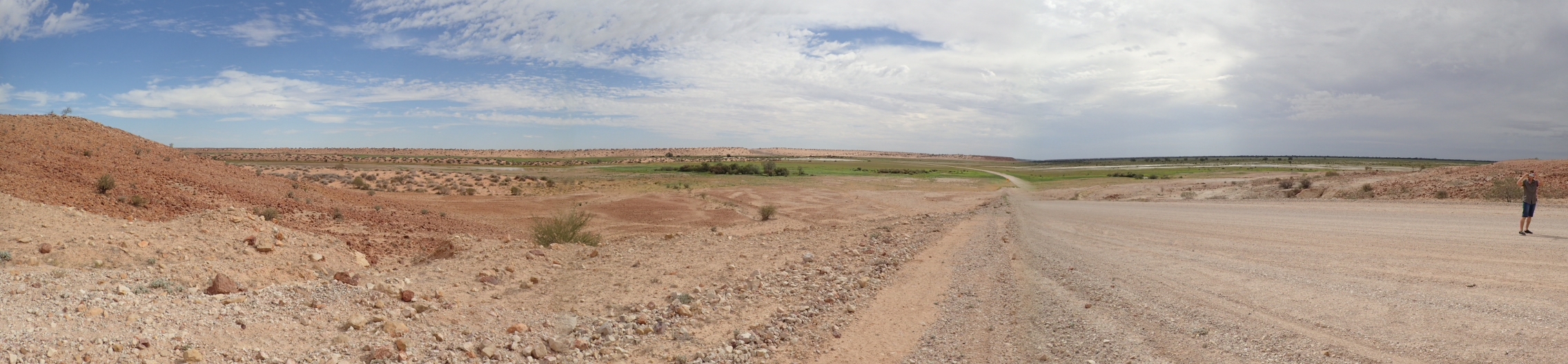
There is a beauty to this large and open land where population is measured not in people per square kilometre but in square kilometres per person and where vegetation and water are sparse. The road is a mix of dirt, sand, rocks with a bit of gravel and clay sprinkled in wherever the road crews think they can spare it. Mostly it is rough and heavily corrugated from the heavy trucks and four wheel drive vehicles that speed along it in a cloud of dust. Outside the wheel tracks the landscape is mostly wide, rock strewn, open spaces with the occasional gum tree and spiky spinfex grass with a clump of cattle thrown in for interest. Andy, our primary bus driver and all around go-to guy calls it, “a brown and rick land.” It is definitely brown and no doubt that it has and continues to make many Australians rich but you better be prepared to carry your own provisions unless you have generations old aboriginal knowledge.
Wearing my fly face
A typical sight when we stop
Friends around the campfire
The next day another 80 or so kilometres took us to our next night’s camp at Cooper’s Creek a well off the dusty road spot with plenty of shade but no available water. We improvised with some sun warmed shower bags and a fold up cabana to scrub off the dust of the day’s ride. Dinner was by the campfire with John playing his recorder to round out the evening. The morning brought a gusting tailwind that pushed our bikes along the rough and rutted roadway all the way to a somewhat civilized oasis known as the Mungerannie Hotel.
Mungerannie camping
The Mungerannie Pub
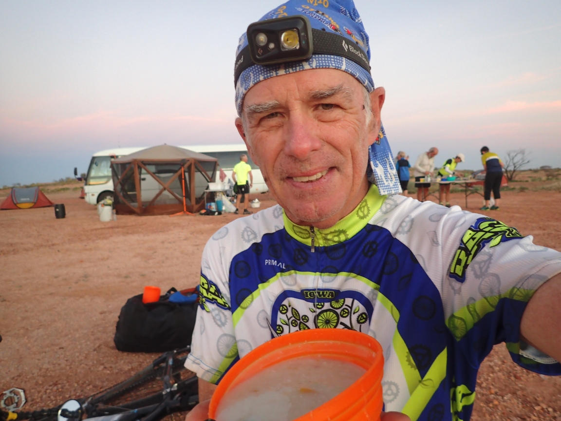
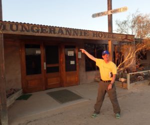
Me at Mungerannie
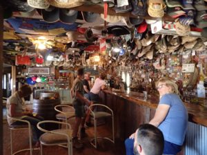
Ah, the Mungerannie Hotel! A welcome sight to travelers of all conveyances and none more so than to some thirsty, dust choked folks on bicycles. Inside its cool, dark and mostly fly free spaces you will find Phil with his time worn, well shaped, grey beard and ancient Australian cattleman’s hat. Phil has a jolly disposition, a ready smile and a twinkle in his eye that lets you know that life here need not be taken too seriously. His fridge is well stocked with cold beverages even in this no too busy season. The ceiling is decorated with numerous hats of various types but mostly of the cattleman variety. There are signs attached to many of them indicating who left them and when. The occasional bra and a few other garments round out the collection. The walls are covered with bumper stickers from all over advertising places, political expressions, sour jokes and stupid sayings. It is a unique and charming place. Phil seems to run the establishment by himself for the most part until business picks up and he does everything from fixing flat tires to pumping gas and cooking meals. In between he tends bar and looks after the campsite and guest rooms. All this done with a light and easy manner. During our stay he shanghaied some local folks to help serve our group of 19 hungry travelers at dinner time.
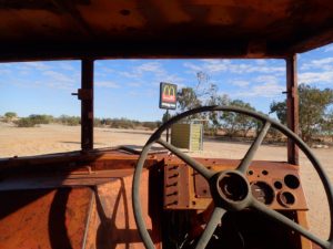
Waiting for a Big Mac
Have you driven this Ford lately?
Canadian content
Our plan was to spend the next day here in Mungerannie with the hope that the Birdsville Track would open up for us ti travel the rest of the way to Birdsville. It is amazing that in a desert area that has had little rain over the past month that a road should be closed due to flooding but such is the nature of this part of the Outback. Two major rain events during the previous two months had loaded the up-gradient lands and that water was now slowly working its was through to Lake Eyre below Birdsville. The result was a five kilometre break in the road due to flooding. While the water was dropping it was still going to take a week or more before even the toughest four wheel drive vehicles could make it through. After exploring every possible alternative, Ralph, the tour organizer, decided we had to make a detour that involved backtracking over the roads we had travelled the past four days. Normally we would have biked another four days to Birdsville. Instead we would spend five hot and sticky days in a bus to get there.
During the afternoon of our layover day in Marree some of the group loaded themselves into the bus for a trip out to Lake Eyre. Lake Eyre is a geological event that may happen only rarely in a person’s lifetime. Between the Simpson and Tirari Deserts is a below sea level salt plane that for most of the time is dry. However, when there are multiple cyclones in the northeast, floodwaters slowly flow to the southwest and create Australia’s largest lake. It is slow process with the lake taking months to fill only to slowly lose this water through evaporation and absorption over time until it is once again dry salt flats. During these rare wet intervals birds, fish and other wildlife flourish in the basin as well as wildflowers and other flora in the many water channels and flood planes that feed it. It also plays havoc with the limited system of roads in the area closing them and isolating many small settlements. More about this later.
The waving man on the Oodnadatta Track
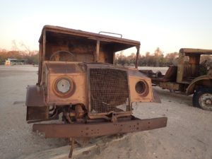
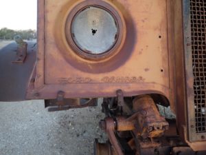
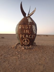
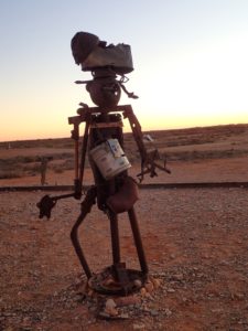
Rust in Peace
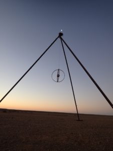
The moon over the pyramid
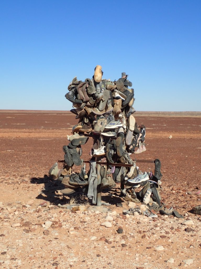
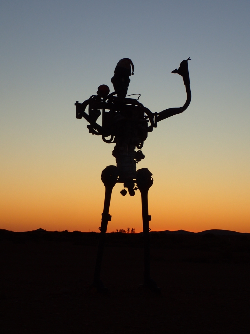
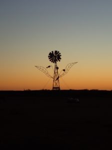
All about the wind
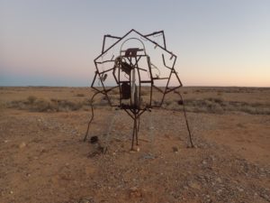
Along the way to Lake Eyre is a large open sky exhibition by a artist reported to live nearby but possibly too modest to post his or her name. These desert sculptures loom large and appear to be constructed of bits and pieces of discarded objects. We happened by just as the sun was setting, giving the works a somewhat surreal appearance.